
Getting around Metro Manila can seem complicated at first, but visitors have plenty of options. Trains, buses, jeepneys, taxis, ride-hailing services and other forms of transport connect different parts of the metropolis, and knowing when to use each can make exploring Manila much easier.
Metro Manila is enormous, so there is no single best way to travel everywhere. The most practical approach is often to combine different forms of transportation depending on where you are going, the time of day and traffic conditions.
Understand the Size of Metro Manila
When visitors talk about Manila, they may be referring to the City of Manila or to the much larger Metro Manila area.
Metro Manila includes cities such as Manila, Makati, Pasay, Taguig, Quezon City and others. Attractions that appear relatively close on a map can therefore require considerably more travelling time than expected.
Plan your days geographically when possible. Visiting several places in the same part of Metro Manila can save a surprising amount of time.
MRT and LRT Trains
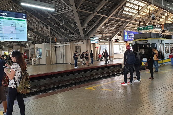
Metro Manila’s urban rail network can be one of the fastest ways to travel along major corridors, particularly when roads are congested.
The MRT and LRT lines connect many important areas of the metropolis, although they do not reach every attraction or neighbourhood.
Trains can become very crowded during peak commuting periods, so visitors who have flexibility may find travelling outside the busiest hours more comfortable.
For routes, stations and service information, visit the official websites for LRT-1, LRT-2 and MRT-3.
Jeepneys
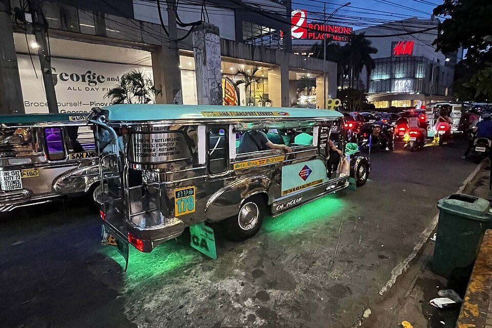
Colourful jeepneys are one of the Philippines’ most recognisable forms of public transportation.
They operate along numerous routes throughout Metro Manila and can be an inexpensive way to travel relatively short distances.
For a first-time visitor, understanding routes and knowing exactly where to get off can take some practice. Asking the driver, conductor or another passenger can help.
A jeepney ride can also be part of experiencing everyday life in Manila rather than simply a way of travelling from one attraction to another.
Buses
Buses serve many routes across Metro Manila, including major roads and connections between different cities.
They can be useful for journeys that are not convenient by rail, although travel times depend heavily on traffic.
Some modern bus services use designated stops and routes, while other services may require a little more local knowledge.
Taxis
Metered taxis remain widely available around Metro Manila.
They can be particularly convenient when travelling with luggage, visiting places away from train stations or making journeys that would otherwise require several changes.
Make sure the meter is used for a regular metered journey.
Ride-Hailing Services
Ride-hailing apps are popular in Metro Manila and can be one of the easiest transportation options for visitors.
You can enter your destination directly into the app, see the expected fare and follow the route on your phone.
They are particularly useful when you are unfamiliar with local public-transport routes or travelling directly between attractions.
Traffic still affects journey times, so allow plenty of time when travelling during busy periods.
Walking
Some parts of Manila are enjoyable to explore on foot.
Intramuros is particularly suitable for walking because many historic attractions are concentrated within the old walled city.
Areas such as BGC and parts of Makati also have pedestrian-friendly districts, while other parts of Metro Manila are better explored using transportation between individual destinations.
For longer sightseeing days, combining walking with trains or ride-hailing can work well.
Travelling During Rush Hour
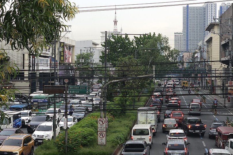
Traffic is one of the biggest factors affecting transportation in Metro Manila.
Morning and late-afternoon commuting periods can significantly increase road travel times, particularly on major routes.
If your schedule allows it, arrange longer journeys outside the busiest periods and group nearby attractions together.
Getting to and From the Airport
Ninoy Aquino International Airport (NAIA) is located within Metro Manila, but travel time between the airport and your accommodation can vary considerably depending on traffic and your terminal.
Allow generous time when travelling to the airport for a departing flight.
For many international visitors, a taxi, hotel transfer or ride-hailing service will be the simplest option when arriving with luggage.
For information about NAIA’s terminals, arrival procedures and airport transfers, read our Manila Airport Guide.
Keep Small Amounts of Cash
Cash remains useful for many forms of local transportation.
Keeping smaller notes and coins available can make paying fares easier, particularly when using jeepneys and some buses.
For app-based transportation, payment options depend on the service and your account settings.
Use Maps — but Allow Extra Time
Digital maps are extremely useful for navigating Metro Manila and checking possible routes.
Treat estimated journey times as a guide rather than a guarantee. Traffic conditions can change quickly, and unfamiliar journeys often take a little longer than expected.
When you have an appointment, flight or other fixed deadline, build extra time into the journey.
The Easiest Approach for Visitors
You do not need to master Manila’s entire transportation system.
Use trains when they conveniently connect your destinations, walk when attractions are close together, and use taxis or ride-hailing when a direct journey makes more sense.
The goal is not to use every type of transport. It is to choose the option that makes each journey simple, practical and enjoyable.
- Photo Credits
- Jeepneys in Metro Manila: Aliceinthealice, via Wikimedia Commons, dedicated to the public domain under CC0 1.0. Cropped/resized by Manila.PH. Source: https://commons.wikimedia.org/wiki/File:Jeepneys_in_Metro_Manila_04.jpg · Licence: https://creativecommons.org/publicdomain/zero/1.0/
- Doroteo Jose LRT-1 Station: Matthew Gan (Ganmatthew), via Wikimedia Commons, licensed under CC BY-SA 4.0. Cropped/resized by Manila.PH. Source: https://commons.wikimedia.org/wiki/File:Doroteo_Jose_LRT-1_LRT_Station_Southbound_Platform_LRTA_Class_1000.jpg · Licence: https://creativecommons.org/licenses/by-sa/4.0/
- Quezon Avenue traffic: Matthew Gan (Ganmatthew), via Wikimedia Commons, licensed under CC BY 4.0. Cropped/resized by Manila.PH. Source: https://commons.wikimedia.org/wiki/File:Quezon_Avenue_Traffic_1.jpg · Licence: https://creativecommons.org/licenses/by/4.0/